County Parks
Paul M Thiede Fire Tower Park
The Paul M. Thiede Fire Tower Park consists of a historic fire tower that is open for the
public to climb, as well as over 3,000 feet of walking trails with interpretive signage. A vaulted toilet is located near the parking lot, and a large picnic shelter is located just a short distance down the main trail. See the Park Brochure or Paul M Thiede Fire Tower Park Sign for more information.
The tower and surrounding 40-acre property was acquired by Crow Wing County from the MN DNR in November of 2018 in an effort to preserve and protect the tower, while also opening it back up for public use. The tower was built in 1935 and remains in excellent shape today.
The park is open year-round from dawn to dusk, with minimal maintenance (i.e. snow plowing) during the winter months. The park is located at 5230 County Road 11, Pequot Lakes, MN 56472, approximately one mile east of downtown Pequot Lakes.
We appreciate your feedback. Click here to submit comments about Paul M Thiede Fire Tower park.
South Long Lake Park
Located at the junction of State Highway 25 and County Road 22 (7 miles south of Brainerd on State Highway 25). This small recreation site is along the southwest river outlet of South Long Lake. This park offers a nice peaceful place to relax and enjoy shore fishing and picnicking. Amenities include picnic tables, BBQ grills, fishing pier, portable toilet from May-Sept and ample parking.
The land was donated to Crow Wing County by John and Barbara Burton in 2003 and Dennis and Pamela Thomsen in 2006. The park was developed in 2007.
The park is open year-round from dawn to dusk, with minimal maintenance (i.e. snow plowing) during the winter months. See the park brochure for more information.
We appreciate your feedback. Click here to submit comments about South Long Lake park.
Milford Mine Memorial Park
Milford Mine Memorial Park is the site of Minnesota’s worst mining disaster. This is the site on the Cuyuna Iron Range where 41 miners lost their lives on February 5, 1924. On that fateful day, around 3:30 in the afternoon, a mine shaft collapsed allowing a flood of water and mud to fill an underground network of tunnels claiming the lives of 41 men. The 200-foot Milford Mine had multiple levels with 1 shaft leading to the surface. Only 7 men made it to the surface alive.
The park is open year round from dawn to dusk, with minimal maintenance (i.e. snow plowing) during the winter months. This park is located at 26351 Milford Lake Dr. Crosby, MN 56441. See the park brochure for more information.
We appreciate your feedback. Click here to submit comments about Milford Mine Memorial park.
Little Emily Lake Park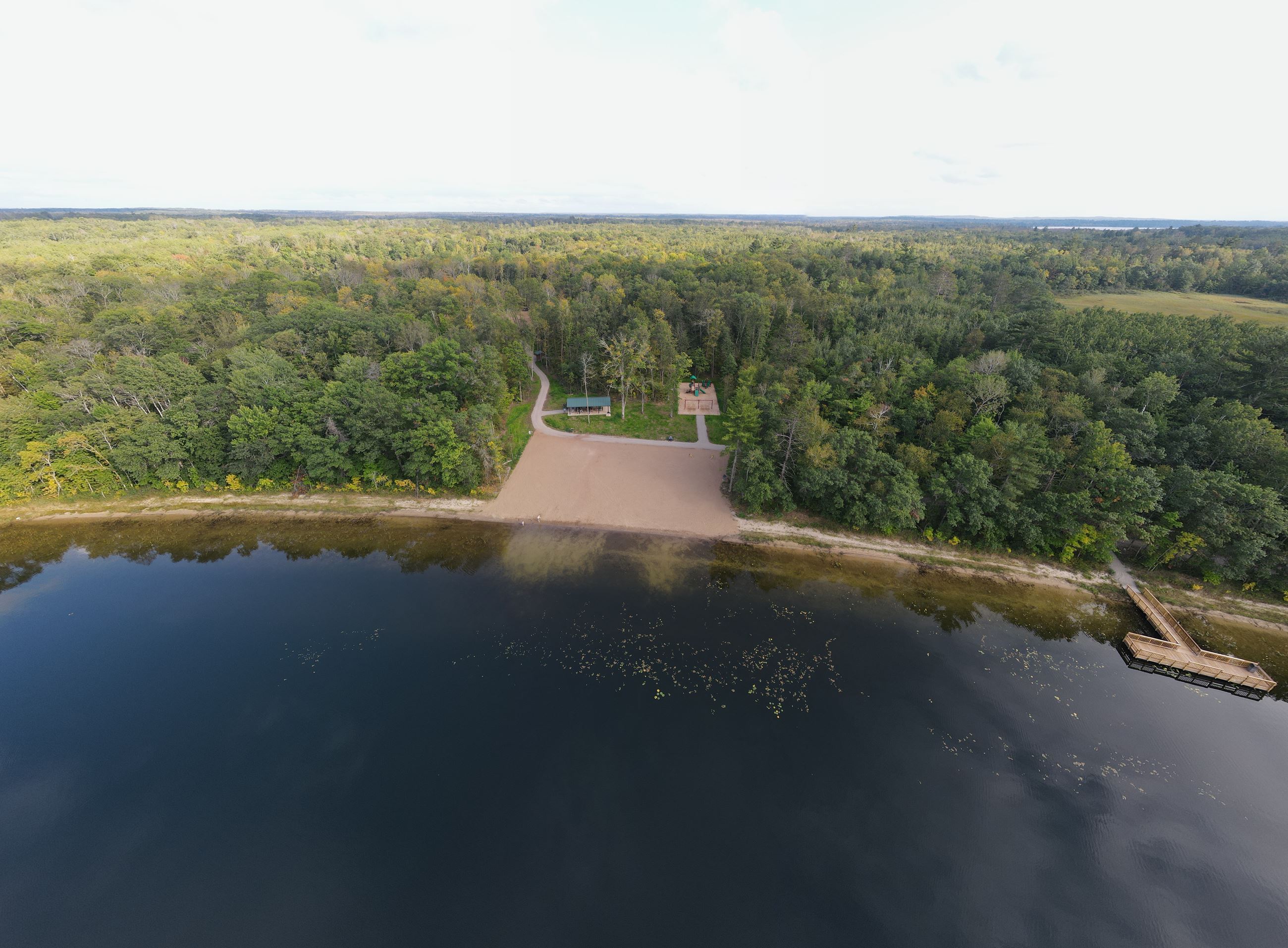
Little Emily Lake Park features a 150’ wide swimming beach, a fishing pier, playground, two pavilions, a canoe/kayak launch, numerous interpretive opportunities and 3.25 miles of non-motorized walking trails. It is located at 21517 Papoose Road Emily MN. From the City of Emily, proceed north on State Highway 6 for approximately 4 miles. The access road into the park will be on your right (east) just after the Wigwam Motel. Proceed down the access road for an additional 1.5 miles to the parking lot. See park brochure for more information.
We appreciate your feedback. Click here to submit comments about Little Emily Lake park.
Rollie Johnson Natural & Recreational Area
The Rollie Johnson Natural and Recreational Area is a series of 2 small and 1 large island known locally as "Big Island". These islands located within Upper Whitefish Lake are open to the public and are managed by the MN-DNR, Crow Wing County and Ideal Township under a Joint Powers Board (JPB) comprised of 7 members.
The JPB, organized in 1992, is the governing body of the Rollie Johnson Natural and Recreational Area which includes Big Island, Steamboat Island and Little Island in Upper Whitefish Lake. Volunteers are utilized to monitor the use of the islands and provide the resources necessary for maintenance and restoration. The only funding is from camper donations and some local organizations. Donation boxes are located in the vicinity of all campsites. The JPB manages the resources in the best interests of the campers and the general public.
Camping is allowed only on designated camping sites. Twelve camp sites are available on a first-come first serve basis. Collecting firewood on site is not allowed, however, firewood is provided near all campsites. See the park brochure for more information.
Rush Lake Island
Rush Lake Island is located on Rush Lake, which is on the Whitefish Chain just west of Crosslake, MN. The remote and primitive landing access to the island is located on the east side of the island. Access to the island is by water craft only. There are few amenities; however this island offers scenic tranquility and a place to enjoy a shore lunch. Gathering of firewood is prohibited. A hiking trail is located on the island. Please pack out any waste or trash brought or found on the island. See the park brochure for more information.